Banstead Village Well
Introduction
The photograph on this page of Banstead Village Well by Marathon as part of the Geograph project.
The Geograph project started in 2005 with the aim of publishing, organising and preserving representative images for every square kilometre of Great Britain, Ireland and the Isle of Man.

There are currently over 7.5m images from over 14,400 individuals and you can help contribute to the project by visiting https://www.geograph.org.uk
Banstead Village Well
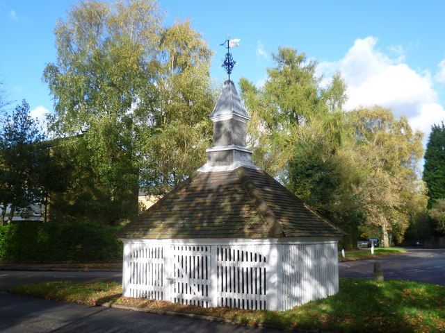
Image: © Marathon Taken: 4 Nov 2013
The Old Well was a public well used by the people in the village until the arrival of pumped water. The 18th century wellhead cover which still houses the elaborate winding gear is a listed building. The well shaft is some 300 feet deep and still exists today. In 2003, the well housing was completely refurbished - see http://www.bansteadhistory.com/well_feature.html
Images are licensed for reuse under creativecommons.org/licenses/by-sa/2.0
Image Location
Latitude
51.324005
Longitude
-0.194393