Division Stone Bolton / Turton boundary
Introduction
The photograph on this page of Division Stone Bolton / Turton boundary by Cliff as part of the Geograph project.
The Geograph project started in 2005 with the aim of publishing, organising and preserving representative images for every square kilometre of Great Britain, Ireland and the Isle of Man.

There are currently over 7.5m images from over 14,400 individuals and you can help contribute to the project by visiting https://www.geograph.org.uk
Division Stone Bolton / Turton boundary
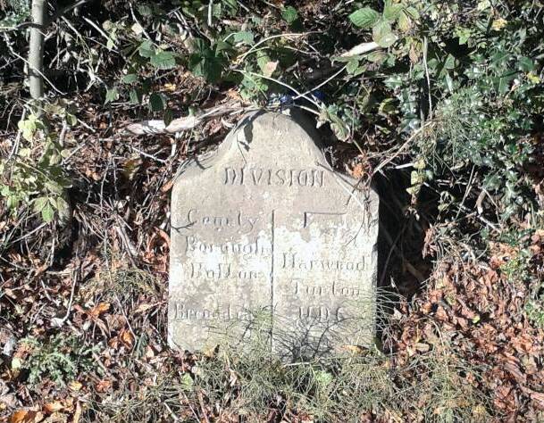
Image: © Cliff Taken: 4 Nov 2013
Division stone at old boundary of Bolton County Borough and Turton UDC on Stitch-mi-Lane
Images are licensed for reuse under creativecommons.org/licenses/by-sa/2.0
Image Location
Latitude
53.594242
Longitude
-2.382514