Down the West Coast Main Line at Kirtlebridge
Introduction
The photograph on this page of Down the West Coast Main Line at Kirtlebridge by Ben Brooksbank as part of the Geograph project.
The Geograph project started in 2005 with the aim of publishing, organising and preserving representative images for every square kilometre of Great Britain, Ireland and the Isle of Man.

There are currently over 7.5m images from over 14,400 individuals and you can help contribute to the project by visiting https://www.geograph.org.uk
Down the West Coast Main Line at Kirtlebridge
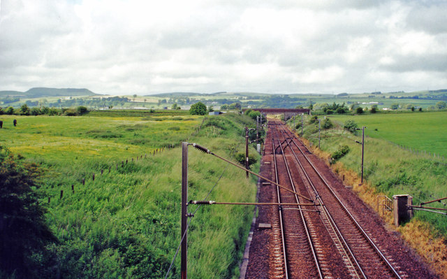
Image: © Ben Brooksbank Taken: 21 Jun 2000
View NW from B722 bridge, towards Beattock Summit, Carstairs and Glasgow/Edinburgh: ex-Caledonian Railway (Carlisle - Glasgow/Edinburgh) section of the WCML, electrified 1974. The view is up the Annan Valley and the flat-topped peak on the left horizon is probably Burnswark (650 ft.), with its Roman forts. (See also Image]).
Images are licensed for reuse under creativecommons.org/licenses/by-sa/2.0
Image Location
Latitude
55.053252
Longitude
-3.214514