Rhyl Road by Goshen Chapel and Texaco petrol station
Introduction
The photograph on this page of Rhyl Road by Goshen Chapel and Texaco petrol station by John S Turner as part of the Geograph project.
The Geograph project started in 2005 with the aim of publishing, organising and preserving representative images for every square kilometre of Great Britain, Ireland and the Isle of Man.

There are currently over 7.5m images from over 14,400 individuals and you can help contribute to the project by visiting https://www.geograph.org.uk
Rhyl Road by Goshen Chapel and Texaco petrol station
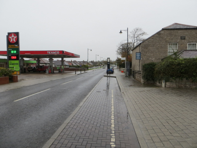
Image: © John S Turner Taken: 1 Nov 2013
Looking north east along Rhyl Road with the Goshen/Gosen Chapel on the right. The old chapel is now the Rhuddlan Evangelical Church. There is a date plaque on the end wall with a date that has been interpreted as 1855, however, the last two numbers are different, and I believe the date is 1835. The Chapels Heritage Society website refers to the chapel being established in the early 1830s, which seems to confirm my opinion - "As with the Calvinistic Methodists the Independents' mother church, Gosen, which had been established in the early 1830s was in Rhuddlan." http://www.capeli.org.uk/uploads/local_25_rhyl.pdf See also Image
Images are licensed for reuse under creativecommons.org/licenses/by-sa/2.0
Image Location
Latitude
53.292483
Longitude
-3.463897