Former National School, Beaumaris
Introduction
The photograph on this page of Former National School, Beaumaris by Jaggery as part of the Geograph project.
The Geograph project started in 2005 with the aim of publishing, organising and preserving representative images for every square kilometre of Great Britain, Ireland and the Isle of Man.

There are currently over 7.5m images from over 14,400 individuals and you can help contribute to the project by visiting https://www.geograph.org.uk
Former National School, Beaumaris
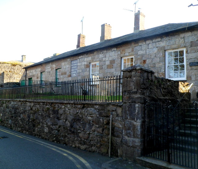
Image: © Jaggery Taken: 27 Mar 2012
Viewed across Steeple Lane, looking towards the corner of Bunker's Hill. The inscription on the wall is NATIONAL SCHOOL ERECTED AD 1816. The 1868 National Gazetteer entry for Beaumaris stated "There is a National school for 120 pupils of each sex."
Images are licensed for reuse under creativecommons.org/licenses/by-sa/2.0
Image Location
Latitude
53.263463
Longitude
-4.095048