Egton Bridge Station coal cells
Introduction
The photograph on this page of Egton Bridge Station coal cells by Trevor Littlewood as part of the Geograph project.
The Geograph project started in 2005 with the aim of publishing, organising and preserving representative images for every square kilometre of Great Britain, Ireland and the Isle of Man.

There are currently over 7.5m images from over 14,400 individuals and you can help contribute to the project by visiting https://www.geograph.org.uk
Egton Bridge Station coal cells
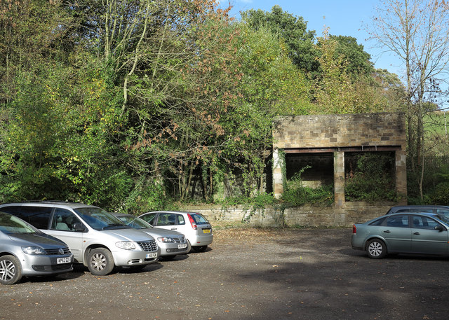
Image: © Trevor Littlewood Taken: 1 Nov 2013
The Esk Valley Line (railway) runs just above the masonry of the two compartments seen right of centre in the image. The coal cells, more usually known as coal drops, were storage facilities for coal which would be loaded from trucks on the railway then discharged into waggons below for delivery. The area below the coal cells is now in use as a car park.
Images are licensed for reuse under creativecommons.org/licenses/by-sa/2.0
Image Location
Latitude
54.437297
Longitude
-0.761162