OS benchmark - corner of Berry Street
Introduction
The photograph on this page of OS benchmark - corner of Berry Street by Richard Law as part of the Geograph project.
The Geograph project started in 2005 with the aim of publishing, organising and preserving representative images for every square kilometre of Great Britain, Ireland and the Isle of Man.

There are currently over 7.5m images from over 14,400 individuals and you can help contribute to the project by visiting https://www.geograph.org.uk
OS benchmark - corner of Berry Street
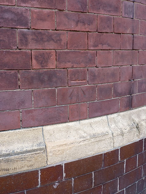
Image: © Richard Law Taken: 4 Sep 2013
OS cutmark in the bricks of what was once an outlier of the Polytechnic (but now presumably belongs to the Uni of Wolverhampton); it was originally levelled at 156.308m above Ordnance Datum Newlyn.
Images are licensed for reuse under creativecommons.org/licenses/by-sa/2.0
Image Location
Latitude
52.586255
Longitude
-2.125207