Former hospital building, Woodside Park
Introduction
The photograph on this page of Former hospital building, Woodside Park by Jim Osley as part of the Geograph project.
The Geograph project started in 2005 with the aim of publishing, organising and preserving representative images for every square kilometre of Great Britain, Ireland and the Isle of Man.

There are currently over 7.5m images from over 14,400 individuals and you can help contribute to the project by visiting https://www.geograph.org.uk
Former hospital building, Woodside Park
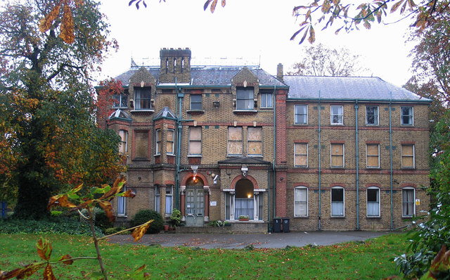
Image: © Jim Osley Taken: 26 Oct 2013
This building, once known as "Norton Lees", is one of a number making up St Luke's Hospital. The site has recently acquired for development by a housing association, although planning permission (once refused), has yet to be secured. A comprehensive account of the buildings on the site may be found at this http://www.planningservices.haringey.gov.uk/portal/servlets/AttachmentShowServlet?ImageName=506044. "Norton Lees" was the nurses' home.
Images are licensed for reuse under creativecommons.org/licenses/by-sa/2.0
Image Location
Latitude
51.587128
Longitude
-0.148325