Stile near Kingstone
Introduction
The photograph on this page of Stile near Kingstone by Derek Harper as part of the Geograph project.
The Geograph project started in 2005 with the aim of publishing, organising and preserving representative images for every square kilometre of Great Britain, Ireland and the Isle of Man.

There are currently over 7.5m images from over 14,400 individuals and you can help contribute to the project by visiting https://www.geograph.org.uk
Stile near Kingstone
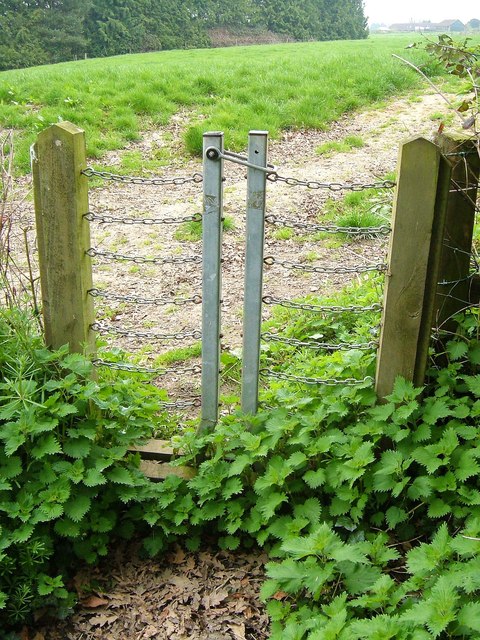
Image: © Derek Harper Taken: 22 Apr 2006
An interesting stile; the halves move away sideways once the catch is lifted and then drop back again. At least, that's how I remember it, seven and a half years on. On this side of the stile, it's footpath CH 14/UN; beyond, it's CH 16/6, as the field boundary is a parish boundary. A reverse view is at Image
Images are licensed for reuse under creativecommons.org/licenses/by-sa/2.0
Image Location


Leaflet Map data © OpenStreetMap
Latitude
50.919921
Longitude
-2.887677