View over Tredegar (2013)
Introduction
The photograph on this page of View over Tredegar (2013) by Robin Drayton as part of the Geograph project.
The Geograph project started in 2005 with the aim of publishing, organising and preserving representative images for every square kilometre of Great Britain, Ireland and the Isle of Man.

There are currently over 7.5m images from over 14,400 individuals and you can help contribute to the project by visiting https://www.geograph.org.uk
View over Tredegar (2013)
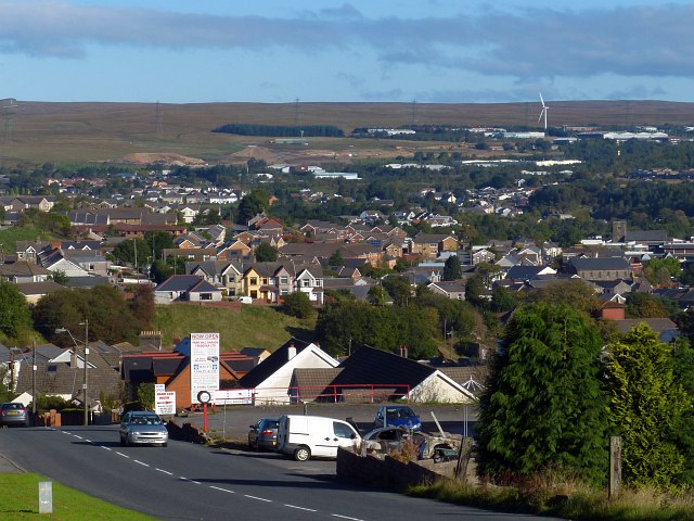
Image: © Robin Drayton Taken: 10 Oct 2013
Looking down Park Hill near Cefn Golau and over the town of Tredegar. A similar view to one taken five years earlier http://www.geograph.org.uk/photo/723221 . Obvious changes are that the canopy over the pumps of the former petrol station in the foreground has been removed, and a wind turbine has been constructed in the Rassau Industrial Estate in the distance http://www.geograph.org.uk/photo/2872372 . Also visible are the mounds of disturbed earth on the moorland beyond the houses and trees. These are the result of the current construction work along the A465 http://www.geograph.org.uk/photo/3652909 . An imminent change will be the construction of the Circuit of Wales motor racing circuit that will eat up 830 acres of the distant moorland behind the Rassau Industrial Estate.
Images are licensed for reuse under creativecommons.org/licenses/by-sa/2.0
Image Location
Latitude
51.768985
Longitude
-3.248719