Site of Hugglescote station
Introduction
The photograph on this page of Site of Hugglescote station by Ben Brooksbank as part of the Geograph project.
The Geograph project started in 2005 with the aim of publishing, organising and preserving representative images for every square kilometre of Great Britain, Ireland and the Isle of Man.

There are currently over 7.5m images from over 14,400 individuals and you can help contribute to the project by visiting https://www.geograph.org.uk
Site of Hugglescote station
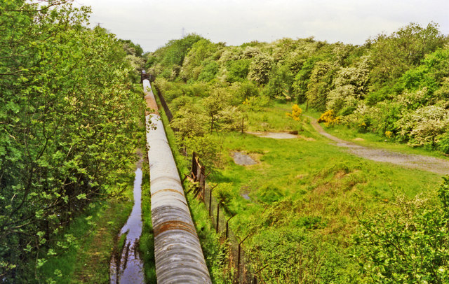
Image: © Ben Brooksbank Taken: 29 May 1995
View westward, towards Nuneaton: ex-LNW & Midland (Nuneaton & Ashby) Joint Railway, Shackerston Junction - Coalville - Loughborough (Derby Road) branch. The station and line closed to passenger traffic from 13/4/31, but goods continued until 6/4/64. Here the track-bed is occupied by a conveyor bringing coal from an overcast site (see http://www.bbc.co.uk/history/domesday/dblock/GB-440000-309000/page/4 ), probably to the Ellistown industrial siding SE of Coalville.
Images are licensed for reuse under creativecommons.org/licenses/by-sa/2.0
Image Location
Latitude
52.705272
Longitude
-1.373182