The M4 Corridor from Mynydd Dinas
Introduction
The photograph on this page of The M4 Corridor from Mynydd Dinas by Kevin Corcoran as part of the Geograph project.
The Geograph project started in 2005 with the aim of publishing, organising and preserving representative images for every square kilometre of Great Britain, Ireland and the Isle of Man.

There are currently over 7.5m images from over 14,400 individuals and you can help contribute to the project by visiting https://www.geograph.org.uk
The M4 Corridor from Mynydd Dinas
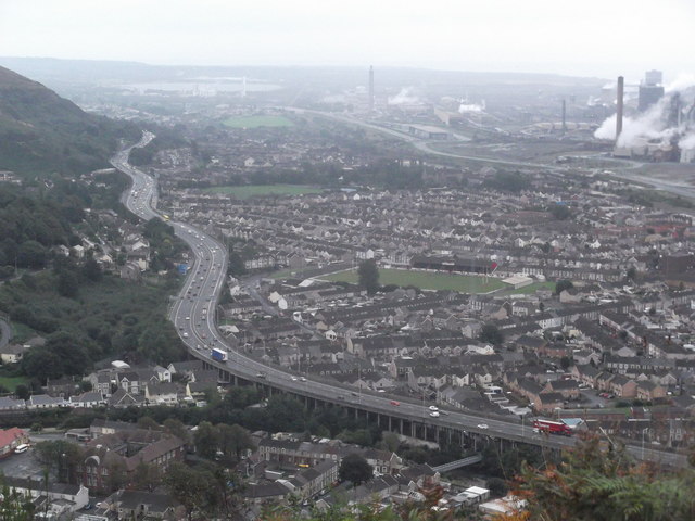
Image: © Kevin Corcoran Taken: 2 Oct 2013
The raised M4 motorway snakes its way through Port Talbot where the coastal plain meets the mountains. Port Talbot Steelworks is in the background.
Images are licensed for reuse under creativecommons.org/licenses/by-sa/2.0
Image Location
Latitude
51.596212
Longitude
-3.775426