Former High School for Girls, Dover Street, Manchester
Introduction
The photograph on this page of Former High School for Girls, Dover Street, Manchester by Stephen Richards as part of the Geograph project.
The Geograph project started in 2005 with the aim of publishing, organising and preserving representative images for every square kilometre of Great Britain, Ireland and the Isle of Man.

There are currently over 7.5m images from over 14,400 individuals and you can help contribute to the project by visiting https://www.geograph.org.uk
Former High School for Girls, Dover Street, Manchester
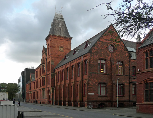
Image: © Stephen Richards Taken: 15 May 2012
Rather like a cross between a church and a small town hall, a tower at the junction. By Mills & Murgatroyd, 1881-86. Grade II listed. In common with most of this grid square, now subsumed into the University of Manchester.
Images are licensed for reuse under creativecommons.org/licenses/by-sa/2.0
Image Location
Latitude
53.465469
Longitude
-2.230574