Rendezvous Street
Introduction
The photograph on this page of Rendezvous Street by John Baker as part of the Geograph project.
The Geograph project started in 2005 with the aim of publishing, organising and preserving representative images for every square kilometre of Great Britain, Ireland and the Isle of Man.

There are currently over 7.5m images from over 14,400 individuals and you can help contribute to the project by visiting https://www.geograph.org.uk
Rendezvous Street
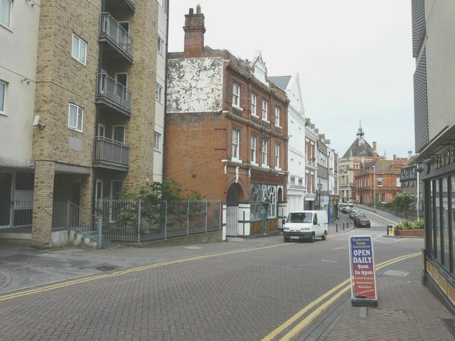
Image: © John Baker Taken: 20 Sep 2013
The first building on the left is the Merchant Place flats, built on the site of Wiltshire's cycle shop, which had been pulled down. To their right is the former Prince Albert Public House which may date from 1841. It closed in 1987 to reopen as Berties in 1989 but this closed a year later and now the building lies empty. The white building beyond was at one time the Savoy Cinema before it closed and became the Metronome bingo hall; it is now boarded up and disused.
Images are licensed for reuse under creativecommons.org/licenses/by-sa/2.0
Image Location
Latitude
51.080712
Longitude
1.181272