View of new housing development from A429 roundabout
Introduction
The photograph on this page of View of new housing development from A429 roundabout by David P Howard as part of the Geograph project.
The Geograph project started in 2005 with the aim of publishing, organising and preserving representative images for every square kilometre of Great Britain, Ireland and the Isle of Man.

There are currently over 7.5m images from over 14,400 individuals and you can help contribute to the project by visiting https://www.geograph.org.uk
View of new housing development from A429 roundabout
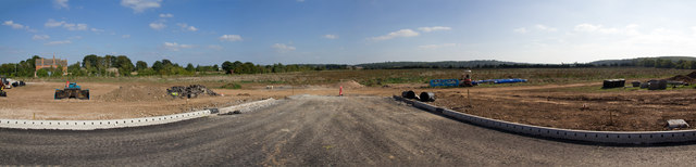
Image: © David P Howard Taken: 29 Sep 2013
A panoramic view looking east from the new roundabout on the A429 Ettington Road. The work on the new roundabout started on 22nd. July 2013, and is due to take 14 weeks. It is the first stage of a large new housing development east of the A429 on the edge of Wellesbourne. This will be the entry road onto the new housing estate.
Images are licensed for reuse under creativecommons.org/licenses/by-sa/2.0
Image Location
Latitude
52.188775
Longitude
-1.596961