High Street
Introduction
The photograph on this page of High Street by Ian Capper as part of the Geograph project.
The Geograph project started in 2005 with the aim of publishing, organising and preserving representative images for every square kilometre of Great Britain, Ireland and the Isle of Man.

There are currently over 7.5m images from over 14,400 individuals and you can help contribute to the project by visiting https://www.geograph.org.uk
High Street
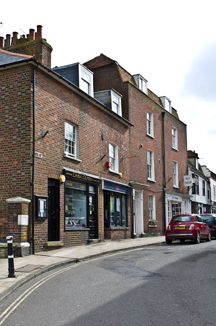
Image: © Ian Capper Taken: 11 May 2013
The eastern end of High Street where it turns into East Cliff. Both buildings here are grade II listed, the nearer one dating from the late 18th/early 19th century and the next one dating from the early 19th century. For listing particulars see www.historicengland.org.uk/listing/the-list/list-entry/1251733 and www.historicengland.org.uk/listing/the-list/list-entry/1251751 respectively.
Images are licensed for reuse under creativecommons.org/licenses/by-sa/2.0
Image Location


Leaflet Map data © OpenStreetMap
Latitude
50.951678
Longitude
0.735197