Heritage paving
Introduction
The photograph on this page of Heritage paving by Neil Owen as part of the Geograph project.
The Geograph project started in 2005 with the aim of publishing, organising and preserving representative images for every square kilometre of Great Britain, Ireland and the Isle of Man.

There are currently over 7.5m images from over 14,400 individuals and you can help contribute to the project by visiting https://www.geograph.org.uk
Heritage paving
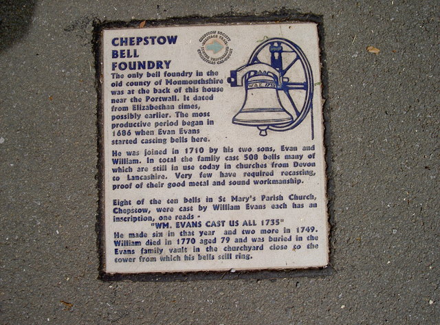
Image: © Neil Owen Taken: 7 Aug 2013
Chepstow has a number of heritage information stones dotted around the place. Unusually, they are embedded in the pavement. See Image] for a wider view of the area next to the entrance to Castle Ditch.
Images are licensed for reuse under creativecommons.org/licenses/by-sa/2.0
Image Location
Latitude
51.642027
Longitude
-2.678725