Former quarry
Introduction
The photograph on this page of Former quarry by Lairich Rig as part of the Geograph project.
The Geograph project started in 2005 with the aim of publishing, organising and preserving representative images for every square kilometre of Great Britain, Ireland and the Isle of Man.

There are currently over 7.5m images from over 14,400 individuals and you can help contribute to the project by visiting https://www.geograph.org.uk
Former quarry
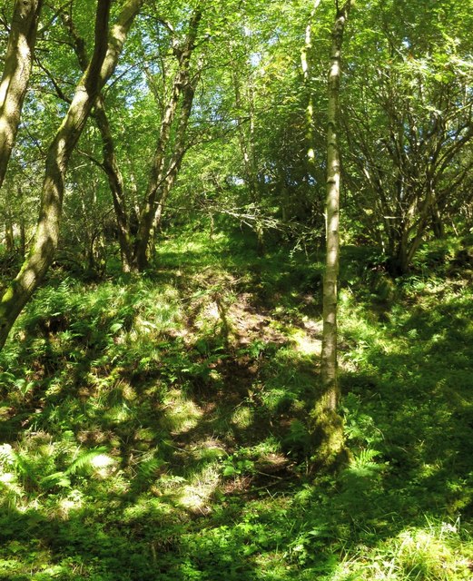
Image: © Lairich Rig Taken: 12 Aug 2013
See Image for another view. The present picture is a view from the lower part of the former quarry, looking up the slope that forms its northern edge. The site now has a fairly dense tree cover, and the ground is very muddy, but it was at or near this spot, at the Image, that a concert was held in October of 1886 to commemorate the official opening of Image (see that link for more details). The audience were seated on the slopes, while the fairly small band occupied a rather cramped fenced-off area down below. Back then, the area did not have the present tree cover, and the ground was considerably drier; in fact, the summer of 1886 had been particularly dry, with the result that the reservoir was slow to fill, a fact that caused some alarm, and which resulted in postponement of the official opening of the reservoir; it had been intended to hold the ceremony a few months earlier. Further, although the sides of this former quarry are fairly steep slopes, the manner in which the quarry had been worked ensured that those slopes had numerous small terraces (better seen in another view – Image), a fact that made seating the concert's audience easier than it might otherwise have been. This western part of the former quarry is quite narrow, so there is not a great deal of level ground at the bottom (see Image); there was not much room here for the band. This area is now fairly inaccessible; in this respect, it might be compared with Murroch Glen (Image), which is just a few miles away; though it would now be considered very much out of the way, the glen was the location of a series of open-air concerts, beginning in June of 1904, and continuing until 1913 [page 162 of "Changing Identities, Ancient Roots" (2006)].
Images are licensed for reuse under creativecommons.org/licenses/by-sa/2.0
Image Location
Latitude
55.973445
Longitude
-4.596585