River Misbourne near a footbridge at Isle of Wight Farm
Introduction
The photograph on this page of River Misbourne near a footbridge at Isle of Wight Farm by David Leeming as part of the Geograph project.
The Geograph project started in 2005 with the aim of publishing, organising and preserving representative images for every square kilometre of Great Britain, Ireland and the Isle of Man.

There are currently over 7.5m images from over 14,400 individuals and you can help contribute to the project by visiting https://www.geograph.org.uk
River Misbourne near a footbridge at Isle of Wight Farm
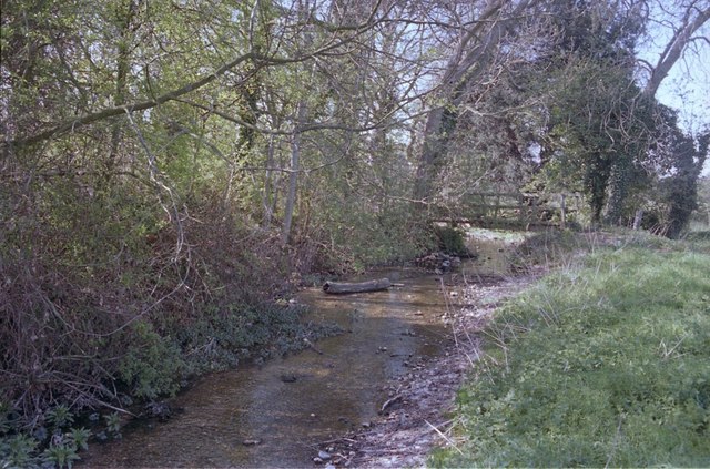
Image: © David Leeming Taken: 7 Apr 1997
This part of the River Misbourne was experiencing extreme low flows when this photograph was taken in the spring of 1997. The river here dried out for several months later that year, becoming dry from source downstream to the discharge point of Gerrards Cross sewage treatment works. Native white-clawed crayfish (Austropotamobius pallipes) were regularly seen in the Misbourne here until the channel dried in 1997. A short reach of the Misbourne here was one of the last places they could still be found across the home counties - from where they are now almost certainly locally extinct. The invasive North American signal crayfish (Pacifastacus leniusculus) is now abundant within the Misbourne, as elsewhere across much of southern England. The spread of this species has eradicated populations of native crayfish as they carry a lethal fungus and outcompete the smaller native species. Although signals first became established within Shardeloes Lake and the upper Misbourne during the early 1990s, the native crayfish population downstream was protected by the isolation caused by a lengthy intermediate section of river that remained perennially dry during this period.
Images are licensed for reuse under creativecommons.org/licenses/by-sa/2.0
Image Location
Latitude
51.586093
Longitude
-0.54027