Maxwelton House
Introduction
The photograph on this page of Maxwelton House by Hugh Close as part of the Geograph project.
The Geograph project started in 2005 with the aim of publishing, organising and preserving representative images for every square kilometre of Great Britain, Ireland and the Isle of Man.

There are currently over 7.5m images from over 14,400 individuals and you can help contribute to the project by visiting https://www.geograph.org.uk
Maxwelton House
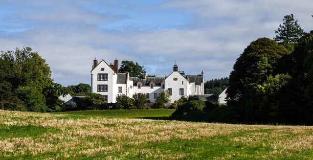
Image: © Hugh Close Taken: 10 Sep 2013
A largely 17th century house,it was B listed in 1971.
Images are licensed for reuse under creativecommons.org/licenses/by-sa/2.0
Image Location
Latitude
55.187411
Longitude
-3.851606