The Mill, Pontrobert
Introduction
The photograph on this page of The Mill, Pontrobert by John Phillips as part of the Geograph project.
The Geograph project started in 2005 with the aim of publishing, organising and preserving representative images for every square kilometre of Great Britain, Ireland and the Isle of Man.

There are currently over 7.5m images from over 14,400 individuals and you can help contribute to the project by visiting https://www.geograph.org.uk
The Mill, Pontrobert
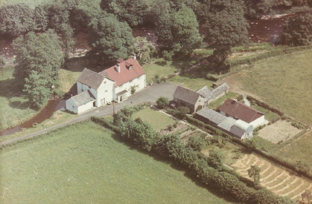
Image: © John Phillips Taken: Unknown
Bought in the late 1930's by my Grandfather this converted watermill on the River Vyrnwy was photographed from the air [from the NW] in the 1970's and is the oldest Geograph I'm likely to submit. The buildings are now altered and improved but substantially the same. The mill stream and mill pool clearly seen here.
Images are licensed for reuse under creativecommons.org/licenses/by-sa/2.0
Image Location


Leaflet Map data © OpenStreetMap
Latitude
52.701015
Longitude
-3.320002