The sluice at Stonar Cut
Introduction
The photograph on this page of The sluice at Stonar Cut by John Baker as part of the Geograph project.
The Geograph project started in 2005 with the aim of publishing, organising and preserving representative images for every square kilometre of Great Britain, Ireland and the Isle of Man.

There are currently over 7.5m images from over 14,400 individuals and you can help contribute to the project by visiting https://www.geograph.org.uk
The sluice at Stonar Cut
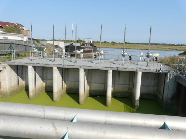
Image: © John Baker Taken: 27 Aug 2013
With a large boat moored beyond. Following a report by Murdock Mackenzie (Maritime Surveyor of His Majesty’s Service) in 1775, The Stonar Cut Act of 1776 was passed enabling a channel controlled by floodgates to be constructed across the neck of a large loop in the River Stour. When there is prolonged heavy rain and the flow in the river is running full, the Stonar Cut gates are opened and part of the flow is diverted down the Stonar Cut direct to the sea, bypassing the town of Sandwich. When this operation is carried out, it is known as ‘running the cut’ and, although the gates are worked by electric motor now, this method of lowering water levels in the river is still used. This operation benefits approximately 3000 acres of land http://www.riverstouridb.org.uk/history.php I noticed in the link that the River Stour had been referred to as the River Great Stour. I wrote to the Clerk of the Board (contact us, on the website) pointing this out and while he was in agreement with me that it should be the River Stour, he didn’t twig that a change should be made to the text. However, I have referred to it as the River Stour in my description
Images are licensed for reuse under creativecommons.org/licenses/by-sa/2.0
Image Location
Latitude
51.301663
Longitude
1.347632