River Ivel (Broom River) above Holme Mill
Introduction
The photograph on this page of River Ivel (Broom River) above Holme Mill by David Leeming as part of the Geograph project.
The Geograph project started in 2005 with the aim of publishing, organising and preserving representative images for every square kilometre of Great Britain, Ireland and the Isle of Man.

There are currently over 7.5m images from over 14,400 individuals and you can help contribute to the project by visiting https://www.geograph.org.uk
River Ivel (Broom River) above Holme Mill
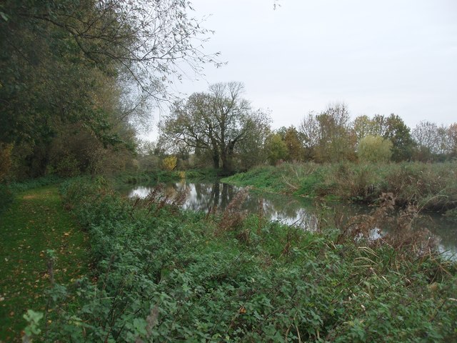
Image: © David Leeming Taken: Unknown
This part of the River Ivel is also known as the Broom River, Ivel Navigation (disused) or Shefford Canal (disused). This image was taken above Holme Mill (also known as Jordans Mill) where the water level is impounded by a weir and by a sluice situated within a disused lock. The sluice is remotely operated by the Environment Agency to regulate flows and control water levels - fine if preventing a flood but annoying when artificial changes in flow or water level occur on a semi hourly basis affecting reaches both downstream and a little upstream of this point. This hourly pulse in river flow is usually shown by water levels recorded at Biggleswade flow gauging station downstream and would be even more noticeable still if flow hydrographs (water volume measurements) were presented http://www.environment-agency.gov.uk/homeandleisure/floods/riverlevels/120732.aspx?stationId=6182. Conversion of the river into a canal over the five miles between Biggleswade and Shefford involved the construction of five locks and was completed in 1823. The canal fell into disuse by the 1870s after the arrival in the area of the Great Northern Railway (1850) and Midland Railway (1857). http://www.eawa.co.uk/ivel.html
Images are licensed for reuse under creativecommons.org/licenses/by-sa/2.0
Image Location
Latitude
52.066909
Longitude
-0.276336