Grand Union Canal: Buckingham Arm
Introduction
The photograph on this page of Grand Union Canal: Buckingham Arm by Nigel Cox as part of the Geograph project.
The Geograph project started in 2005 with the aim of publishing, organising and preserving representative images for every square kilometre of Great Britain, Ireland and the Isle of Man.

There are currently over 7.5m images from over 14,400 individuals and you can help contribute to the project by visiting https://www.geograph.org.uk
Grand Union Canal: Buckingham Arm
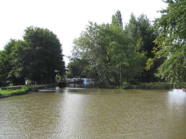
Image: © Nigel Cox Taken: 1 Sep 2013
This is the point in Cosgrove at which the long-abandoned Buckingham Arm takes off from the main line of the Grand Union Canal. Opened in 1801 to much jubilation in Buckingham, it rapidly began to suffer from the usual canal problems of competition from the railways and water leakage. Additional problems on this arm in particular were the amount of silt in the water supply which filled the bed and made navigation increasingly difficult, and the propensity of the Buckingham Corporation, after all their initial enthusiasm, to use the canal as a disposal point for sewage. The canal was not used beyond 1932, and formally abandoned in 1964 by which time its route had become blocked with new roads anyway. However moves are afoot to reopen it. The reach of the old canal, visible here, from the junction, is watered for about 230 metres, but serves as a marina only. There are no turning facilities for long narrowboats...
Images are licensed for reuse under creativecommons.org/licenses/by-sa/2.0
Image Location
Latitude
52.073015
Longitude
-0.842085