Belston Loch
Introduction
The photograph on this page of Belston Loch by M J Richardson as part of the Geograph project.
The Geograph project started in 2005 with the aim of publishing, organising and preserving representative images for every square kilometre of Great Britain, Ireland and the Isle of Man.

There are currently over 7.5m images from over 14,400 individuals and you can help contribute to the project by visiting https://www.geograph.org.uk
Belston Loch
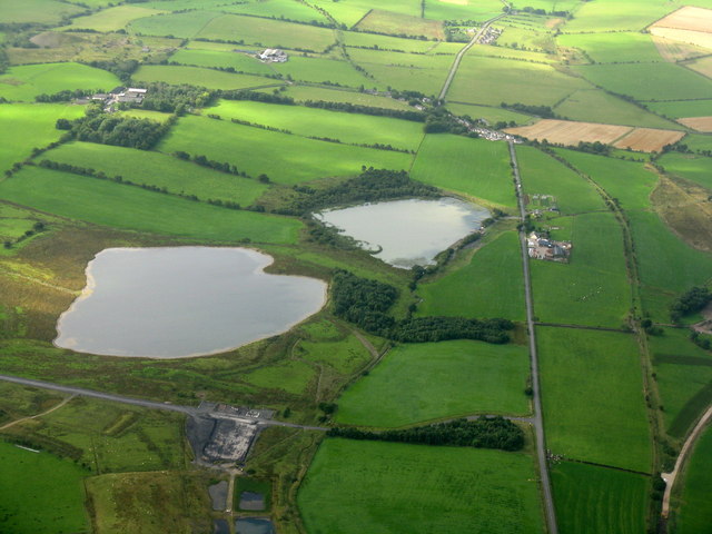
Image: © M J Richardson Taken: 5 Sep 2013
The named loch is to the right. The one on the left is one of two associated with opencast mining in the area Image The road on the right is the B7046 to Sinclairston and Drongan.
Images are licensed for reuse under creativecommons.org/licenses/by-sa/2.0
Image Location
Latitude
55.426707
Longitude
-4.401559