St . Peter and Paul, Nutfield
Introduction
The photograph on this page of St . Peter and Paul, Nutfield by Hywel Williams as part of the Geograph project.
The Geograph project started in 2005 with the aim of publishing, organising and preserving representative images for every square kilometre of Great Britain, Ireland and the Isle of Man.

There are currently over 7.5m images from over 14,400 individuals and you can help contribute to the project by visiting https://www.geograph.org.uk
St . Peter and Paul, Nutfield
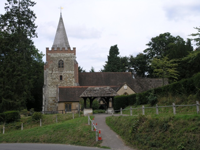
Image: © Hywel Williams Taken: 11 Aug 2005
The original church dates back to the early 1200s with the tower built in the early 1400s. Major structural work had to be done after the church was struck by a V1 bomb in 1944. The Churchyard is considered a "Living Churchyard", where part of the churchyard is left uncut until many of the wild flowers have blossomed.
Images are licensed for reuse under creativecommons.org/licenses/by-sa/2.0
Image Location


Leaflet Map data © OpenStreetMap
Latitude
51.241368
Longitude
-0.126139