Old Toll House on Glastonbury-Wedmore road
Introduction
The photograph on this page of Old Toll House on Glastonbury-Wedmore road by Edwin Graham as part of the Geograph project.
The Geograph project started in 2005 with the aim of publishing, organising and preserving representative images for every square kilometre of Great Britain, Ireland and the Isle of Man.

There are currently over 7.5m images from over 14,400 individuals and you can help contribute to the project by visiting https://www.geograph.org.uk
Old Toll House on Glastonbury-Wedmore road
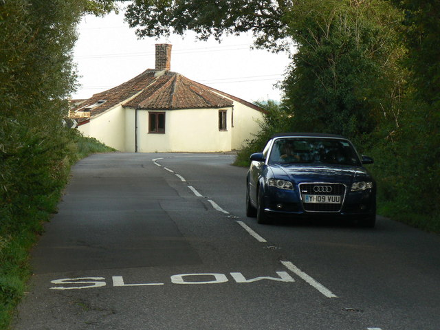
Image: © Edwin Graham Taken: 28 Aug 2013
The building is shown in the 1844 Tithe Map, which also shows a gate across the turnpike road! The two windows enable the turnpike toll collector to see approaching traffic (horses and carts in those days). Nowadays the road is the B3151. The building has tilted over due to being built on peat, though it is inhabited and in good condition.
Images are licensed for reuse under creativecommons.org/licenses/by-sa/2.0
Image Location
Latitude
51.185538
Longitude
-2.803058