Knockholt station
Introduction
The photograph on this page of Knockholt station by Marathon as part of the Geograph project.
The Geograph project started in 2005 with the aim of publishing, organising and preserving representative images for every square kilometre of Great Britain, Ireland and the Isle of Man.

There are currently over 7.5m images from over 14,400 individuals and you can help contribute to the project by visiting https://www.geograph.org.uk
Knockholt station
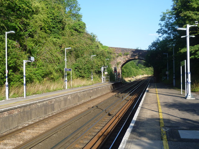
Image: © Marathon Taken: 27 Aug 2013
The South Eastern Railway (SER) opened their "cut off" line through Orpington and Sevenoaks to Tonbridge on 2nd March 1868. This shortened its route from London to Dover which previously went via Redhill. At this time there was no station between Chelsfield and Dunton Green. After local pressure, Halstead for Knockholt station was opened on 1st May 1876. It was much closer to Halstead than Knockholt but was renamed Knockholt on 1st October 1900 to avoid confusion with Halstead station in Essex. From 1994 until 2003 Eurostars ran through Knockholt to and from the Channel Tunnel. The station is in a cutting in the chalk. This view is from the up platform looking in the direction of Badgers Mount Tunnel and Sevenoaks. The bridge ahead carries a footpath. For a view on the bridge see http://www.geograph.org.uk/photo/3626330
Images are licensed for reuse under creativecommons.org/licenses/by-sa/2.0
Image Location


Leaflet Map data © OpenStreetMap
Latitude
51.345595
Longitude
0.131556