Shewbread Quaker Burial Ground
Introduction
The photograph on this page of Shewbread Quaker Burial Ground by Paul Glazzard as part of the Geograph project.
The Geograph project started in 2005 with the aim of publishing, organising and preserving representative images for every square kilometre of Great Britain, Ireland and the Isle of Man.

There are currently over 7.5m images from over 14,400 individuals and you can help contribute to the project by visiting https://www.geograph.org.uk
Shewbread Quaker Burial Ground
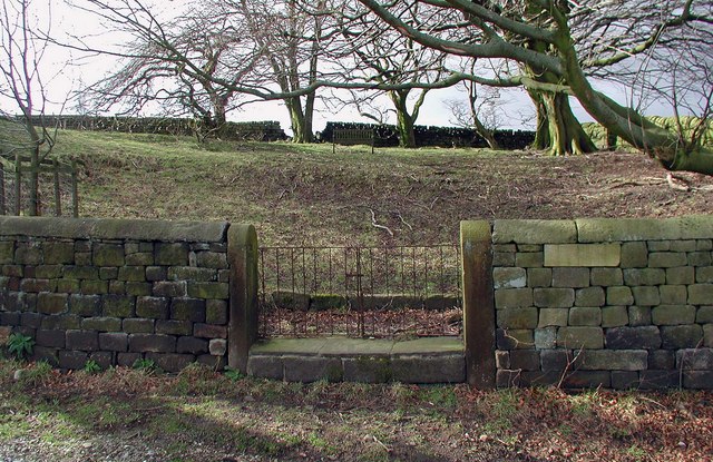
Image: © Paul Glazzard Taken: 8 Mar 2007
Walled enclosure on Shoebroad Lane on the hillside high above Todmorden. A stone tablet near the gate bears the inscription "Shewbread Quaker Burial Ground c.1668". The "Shoebroad" of Shoebroad Lane is apparently a corruption of the biblical "shewbread", the table where God speaks to man and nourishes him.
Images are licensed for reuse under creativecommons.org/licenses/by-sa/2.0
Image Location


Leaflet Map data © OpenStreetMap
Latitude
53.708245
Longitude
-2.097677