
Railway Terrace, Stanley Hill Top, Crook
Introduction
The photograph on this page of Railway Terrace, Stanley Hill Top, Crook by Tom Jolliffe as part of the Geograph project.
The Geograph project started in 2005 with the aim of publishing, organising and preserving representative images for every square kilometre of Great Britain, Ireland and the Isle of Man.

There are currently over 7.5m images from over 14,400 individuals and you can help contribute to the project by visiting https://www.geograph.org.uk
Railway Terrace, Stanley Hill Top, Crook
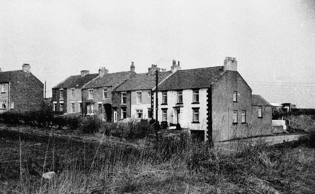
Image: © Tom Jolliffe Taken: Unknown
The house at the end of this row was a former pub, called the Forresters. This village was classified as category "D" in the 1960s and damned to have no development. However, this policy was later abandoned. A railway ran up to this high point from Crook, up "the fearsome Stanley incline", no doubt pulled by cable or with special wheels like cogs. It was said that residents could hear the pitmen walking underground as they went to work. A reservoir lies to the rear of these houses.
Images are licensed for reuse under creativecommons.org/licenses/by-sa/2.0
Image Location

Latitude
54.732467
Longitude
-1.737837