Navigation House, Navigation Yard, Carre Street
Introduction
The photograph on this page of Navigation House, Navigation Yard, Carre Street by Jo and Steve Turner as part of the Geograph project.
The Geograph project started in 2005 with the aim of publishing, organising and preserving representative images for every square kilometre of Great Britain, Ireland and the Isle of Man.

There are currently over 7.5m images from over 14,400 individuals and you can help contribute to the project by visiting https://www.geograph.org.uk
Navigation House, Navigation Yard, Carre Street
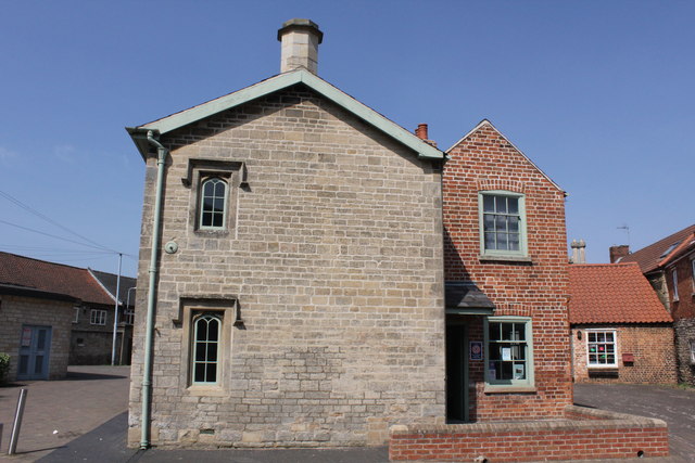
Image: © Jo and Steve Turner Taken: 25 Apr 2011
Grade II Listed this building is probably unique in being the only example of specially built Company Offices to exist on a rural waterway. It was finished in 1839 and consisted of an office for the Clerk with the weighing machine in it, a Committee Room for meetings and two upstairs rooms that were to provide accommodation for the Clerk. A small brick extension was later added at the back. After the Sleaford Navigation Company was wound up in 1878, Navigation House continued to be used as a dwelling until the 1950’s when the building gradually fell into disrepair. The building escaped demolition in the 1970s thanks to the Sleaford Navigation Society and with help from the Heritage Lottery and Sleaford Pride it opened as a visitor centre for the Sleaford Navigation in 2005.
Images are licensed for reuse under creativecommons.org/licenses/by-sa/2.0
Image Location
Latitude
52.998858
Longitude
-0.408136