View towards Hoo St Werburgh from the Saxon Shore Way
Introduction
The photograph on this page of View towards Hoo St Werburgh from the Saxon Shore Way by Marathon as part of the Geograph project.
The Geograph project started in 2005 with the aim of publishing, organising and preserving representative images for every square kilometre of Great Britain, Ireland and the Isle of Man.

There are currently over 7.5m images from over 14,400 individuals and you can help contribute to the project by visiting https://www.geograph.org.uk
View towards Hoo St Werburgh from the Saxon Shore Way
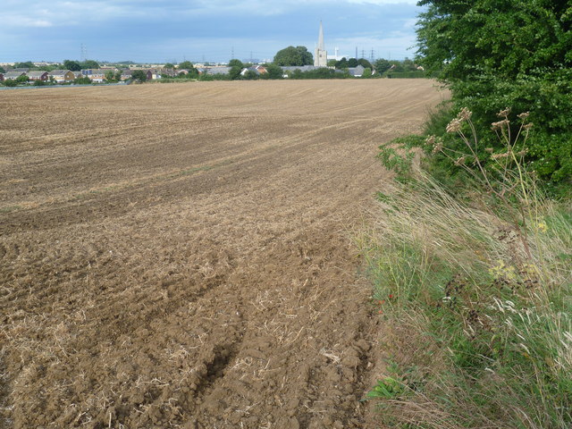
Image: © Marathon Taken: 15 Aug 2013
The Saxon Shore Way follows Kent's ancient coastline. In many places this is now miles inland. The Saxon Shore Way is named after the line of historic fortifications that defended the Kent coast at the end of the Roman era. It is 160 miles long and runs from Gravesend to Hastings. Here it is heading downhill towards Hoo St Werburgh and the Medway Estuary. The edge of the village can be seen ahead along with the spire of St Werburgh Church.
Images are licensed for reuse under creativecommons.org/licenses/by-sa/2.0
Image Location


Leaflet Map data © OpenStreetMap
Latitude
51.416293
Longitude
0.557833