
Roseneath Street
Introduction
The photograph on this page of Roseneath Street by Lairich Rig as part of the Geograph project.
The Geograph project started in 2005 with the aim of publishing, organising and preserving representative images for every square kilometre of Great Britain, Ireland and the Isle of Man.

There are currently over 7.5m images from over 14,400 individuals and you can help contribute to the project by visiting https://www.geograph.org.uk
Roseneath Street
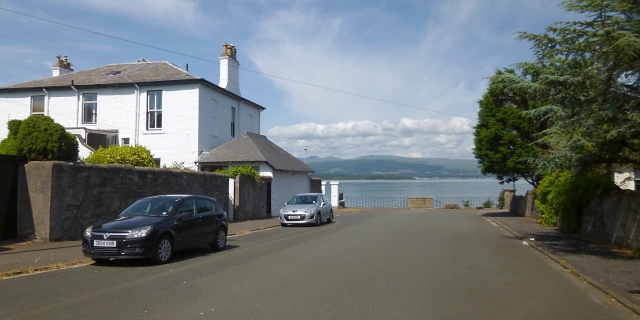
Image: © Lairich Rig Taken: 8 Jul 2013
Out in the Clyde, directly ahead, is the end of the Rosneath Peninsula. In the past, the name of Rosneath (Image) was sometimes spelled "Roseneath"; the Greenock street name has preserved that particular variation. Visible at Image is the back of the John Galt Memorial Fountain; on either side of it, steps lead down to the Esplanade: see Image [An aside: although the place-name Rosneath (Image) is pronounced "rose-neath" – [rozniθ] – the present-day spelling "Rosneath" better reflects its etymology: the name appears to signify the "headland or promontory" (Gaelic "ros") of Neath; for the "Neath" element, see Image]
Images are licensed for reuse under creativecommons.org/licenses/by-sa/2.0
Image Location

Latitude
55.961889
Longitude
-4.784096