Bovey Tracey : Holy Well & Bus Stop
Introduction
The photograph on this page of Bovey Tracey : Holy Well & Bus Stop by Lewis Clarke as part of the Geograph project.
The Geograph project started in 2005 with the aim of publishing, organising and preserving representative images for every square kilometre of Great Britain, Ireland and the Isle of Man.

There are currently over 7.5m images from over 14,400 individuals and you can help contribute to the project by visiting https://www.geograph.org.uk
Bovey Tracey : Holy Well & Bus Stop
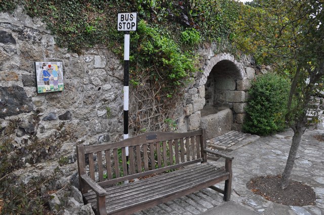
Image: © Lewis Clarke Taken: 12 Aug 2013
Apart from a legend no definite historical information is known regarding this holy well. In common with many wells, the early history of St Mary's Well, Bovey Tracey is based on speculation. It's position within the Anglo-Saxon settlement known as Boffa suggests that it would have been utilised from this date, but the form of the original structure and whether the well had pre-Christian significance or was first established for domestic purposes only is not known. The nearby church is now dedicated to St Peter, St Paul and St Thomas but was previously dedicated to St Mary. The legend surrounding the well states that the priest of the parish church (St. Mary's as it was then) returned home to find a visitor. The pious priest and his wife shared their meagre supper with the visitor (St Mary), ensuring she was cared for and sheltered. In return for his kindness, she bestowed good fortune on the priest and his family for generations to come and by way to remind them she turned the frogs in the spring golden coloured.
Images are licensed for reuse under creativecommons.org/licenses/by-sa/2.0
Image Location
Latitude
50.594983
Longitude
-3.668525