The Apple Tree, Lowther Street
Introduction
The photograph on this page of The Apple Tree, Lowther Street by Rose and Trev Clough as part of the Geograph project.
The Geograph project started in 2005 with the aim of publishing, organising and preserving representative images for every square kilometre of Great Britain, Ireland and the Isle of Man.

There are currently over 7.5m images from over 14,400 individuals and you can help contribute to the project by visiting https://www.geograph.org.uk
The Apple Tree, Lowther Street
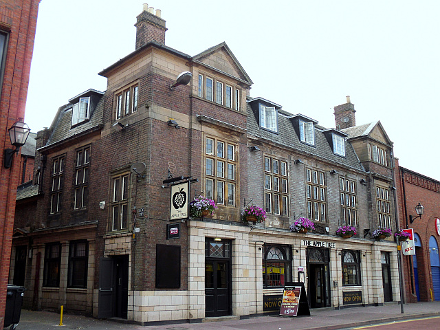
Image: © Rose and Trev Clough Taken: 16 Jul 2013
One of several pubs in the Carlisle district designed by Harry Redfern, chief architect for the State Management Scheme (government control of alcohol - see h2g2 article http://h2g2.com/approved_entry/A644645 ). The pub was built in 1925 - English Heritage has a detailed description and background history http://www.imagesofengland.org.uk/details/default.aspx?id=469182 . The name of the pub was changed to 'Pippins' in the 1980s (see Geograph photo, 2008 http://www.geograph.org.uk/photo/2180420 ), but it reverted to its original name after a renovation in 2013.
Images are licensed for reuse under creativecommons.org/licenses/by-sa/2.0
Image Location
Latitude
54.89442
Longitude
-2.933747