Gwersyllt station
Introduction
The photograph on this page of Gwersyllt station by Ben Brooksbank as part of the Geograph project.
The Geograph project started in 2005 with the aim of publishing, organising and preserving representative images for every square kilometre of Great Britain, Ireland and the Isle of Man.

There are currently over 7.5m images from over 14,400 individuals and you can help contribute to the project by visiting https://www.geograph.org.uk
Gwersyllt station
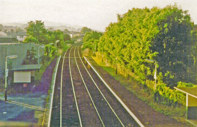
Image: © Ben Brooksbank Taken: 5 Aug 1995
View northward, towards Hawarden Bridge, Chester and Bidston: ex-GCR (Wrexham & Connah's Quay section), Seacombe (until 4/1/60) - Bidston - Hawarden Bridge - Wrexham Central line, also (until 9/9/68) Chester Northgate - Hawarden Bridge. This is a remarkable line, a penetration of the LNER (ex-GCR) into Wales, which remains active as a 'commuter' line and even as a freight outlet from Merseyside (Birkenhead).
Images are licensed for reuse under creativecommons.org/licenses/by-sa/2.0
Image Location
Latitude
53.072923
Longitude
-3.018941