Roundabout at Whitebirk, Blackburn (J6 on M65)
Introduction
The photograph on this page of Roundabout at Whitebirk, Blackburn (J6 on M65) by Mike and Kirsty Grundy as part of the Geograph project.
The Geograph project started in 2005 with the aim of publishing, organising and preserving representative images for every square kilometre of Great Britain, Ireland and the Isle of Man.

There are currently over 7.5m images from over 14,400 individuals and you can help contribute to the project by visiting https://www.geograph.org.uk
Roundabout at Whitebirk, Blackburn (J6 on M65)
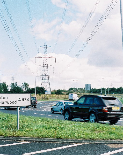
Image: © Mike and Kirsty Grundy Taken: 6 Aug 2005
When M65 reached here from Hyndburn (junction 7) in December 1984, it was anticipated that its continuation to the southwest would fly over this junction and plough right through Blackburn on its way to Preston. However, fashions change in road-building, and it turned out that the people of the town weren't very enthusiastic about high-speed traffic passing their front doors night and day, so the road constructed in the mid-1990s takes a sharp southward turn to go around Blackburn. This roundabout remains as a testimony to something started, but not quite finished. Straight ahead, towards the pylon, we can see an open patch of unused ground between the east-facing slip roads, where the M65 mainline would have been built in the original plans. The pair of slip roads further back (running past the large rectangular sign facing away from us) are built side-by-side, with no need to leave a gap in between until they diverge for the on-slip to pass under the motorway (out of sight from here).
Images are licensed for reuse under creativecommons.org/licenses/by-sa/2.0
Image Location


Leaflet Map data © OpenStreetMap
Latitude
53.756184
Longitude
-2.442225