St Michael and St Wulfad's Church, Stone
Introduction
The photograph on this page of St Michael and St Wulfad's Church, Stone by David Dixon as part of the Geograph project.
The Geograph project started in 2005 with the aim of publishing, organising and preserving representative images for every square kilometre of Great Britain, Ireland and the Isle of Man.

There are currently over 7.5m images from over 14,400 individuals and you can help contribute to the project by visiting https://www.geograph.org.uk
St Michael and St Wulfad's Church, Stone
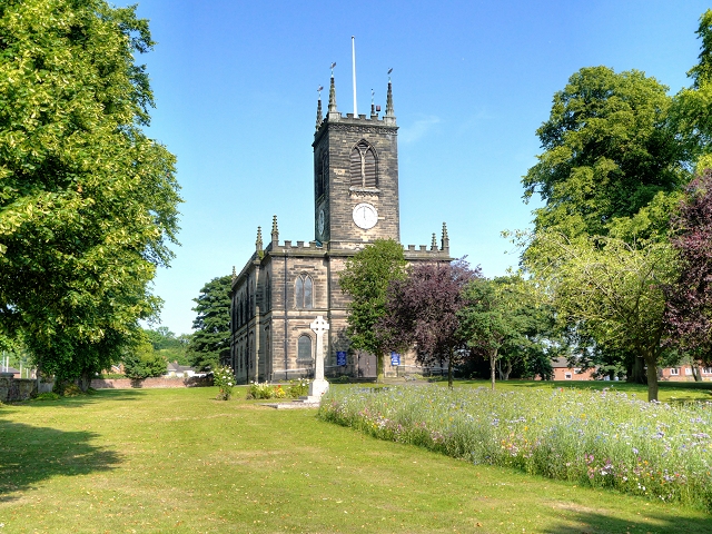
Image: © David Dixon Taken: 11 Jul 2013
The Town of Stone was named after the pile of stone raised on the graves of the Princes killed in 665AD by their father, King Wulfhere of Mercia, because of their conversion to Christianity. The Church, built over these stones in 670 AD, was replaced in 1135 AD by an Augustinian Priory, which survived until its dissolution in the reign of Henry VIII. The priory church survived as a place of worship until the building collapsed in 1749 and the present parish church dedicated to St Michael and St. Wulfad, an early example of the Gothic Revival style, was built in the 1750s using stone from the priory. The church is a Grade II* Listed Building (http://www.britishlistedbuildings.co.uk/en-385977-church-of-st-michael-stone-staffordshire British Listed Buildings) More information at http://www.thepotteries.org/tour/003.htm (Stoke-on-Trent Architecture)
Images are licensed for reuse under creativecommons.org/licenses/by-sa/2.0
Image Location
Latitude
52.901642
Longitude
-2.14357