Barngate Street, Leek
Introduction
The photograph on this page of Barngate Street, Leek by David Weston as part of the Geograph project.
The Geograph project started in 2005 with the aim of publishing, organising and preserving representative images for every square kilometre of Great Britain, Ireland and the Isle of Man.

There are currently over 7.5m images from over 14,400 individuals and you can help contribute to the project by visiting https://www.geograph.org.uk
Barngate Street, Leek
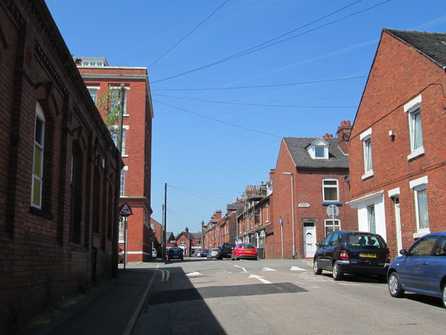
Image: © David Weston Taken: 11 Jul 2013
Terrace housing west of the town centre. The four-storey building on the left, where Barngate Street intersects with Waterloo Street, is Waterloo Mill, which was converted a few years ago into flats. The closer building on the left, in shadow, is the Slimma clothing factory, now disused.
Images are licensed for reuse under creativecommons.org/licenses/by-sa/2.0
Image Location
Latitude
53.105149
Longitude
-2.032671