
Road from Ruckland joins the A16 at Haugham Top
Introduction
The photograph on this page of Road from Ruckland joins the A16 at Haugham Top by Chris as part of the Geograph project.
The Geograph project started in 2005 with the aim of publishing, organising and preserving representative images for every square kilometre of Great Britain, Ireland and the Isle of Man.

There are currently over 7.5m images from over 14,400 individuals and you can help contribute to the project by visiting https://www.geograph.org.uk
Road from Ruckland joins the A16 at Haugham Top
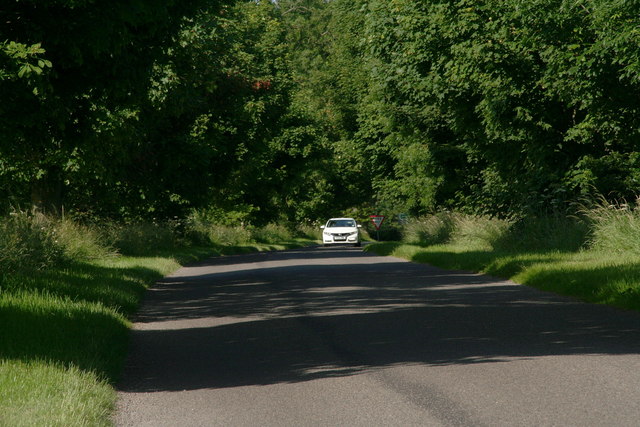
Image: © Chris Taken: 9 Jul 2013
Shadow stripes on a bright sunlit afternoon (one of the first this year) in July. The youngish trees are evenly spaced along nearly half a mile of road, creating a stroboscopic effect as you drive through. On the side of this road, I am told, probably in the 1980's and maybe earlier, was one of the first "farm shops". It was a simple booth or stall and specialised in peas and strawberries. There was a lot of pea-farming in the immediate area, and a pea processing plant a few hundred yards away where all the local farmers brought their peas. See: Image
Images are licensed for reuse under creativecommons.org/licenses/by-sa/2.0
Image Location

Latitude
53.315864
Longitude
0.01287