The Woolpack
Introduction
The photograph on this page of The Woolpack by Stuart Logan as part of the Geograph project.
The Geograph project started in 2005 with the aim of publishing, organising and preserving representative images for every square kilometre of Great Britain, Ireland and the Isle of Man.

There are currently over 7.5m images from over 14,400 individuals and you can help contribute to the project by visiting https://www.geograph.org.uk
The Woolpack
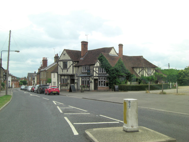
Image: © Stuart Logan Taken: 23 Jun 2013
Originally a 15th C. dwelling it was altered in the 16th & 20th C. and is now Grade II listed with English Heritage Building ID: 116082. See also: http://www.britishlistedbuildings.co.uk/en-116082-the-woolpack-inn-coggeshall-essex
Images are licensed for reuse under creativecommons.org/licenses/by-sa/2.0
Image Location
Latitude
51.874149
Longitude
0.69053