Swing bridge at Old Kilpatrick
Introduction
The photograph on this page of Swing bridge at Old Kilpatrick by Lairich Rig as part of the Geograph project.
The Geograph project started in 2005 with the aim of publishing, organising and preserving representative images for every square kilometre of Great Britain, Ireland and the Isle of Man.

There are currently over 7.5m images from over 14,400 individuals and you can help contribute to the project by visiting https://www.geograph.org.uk
Swing bridge at Old Kilpatrick
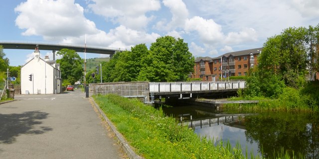
Image: © Lairich Rig Taken: 17 Jun 2013
The bridge is on the Forth and Clyde Canal. Unlike the bascule bridges to be seen nearby on the canal (see, for example, Image), this one pivots around a vertical axis. Erkine Ferry Road crosses the canal by means of this bridge. The Erskine Bridge is prominent in the background. The route receding directly from the photographer's position is the cycle route. For the building on the left, see Image; according to text that is etched onto its windows, it dates from "c.1842" (the occupant informed me that the authority for this date is the house's title deeds). I have submitted this fairly wide view to show the bridge in context, and in relation to nearby structures, but there are several earlier pictures of it; see those for more information: Image / Image / Image
Images are licensed for reuse under creativecommons.org/licenses/by-sa/2.0
Image Location
Latitude
55.920696
Longitude
-4.45588