York Street demolition work, Belfast (2013-4)
Introduction
The photograph on this page of York Street demolition work, Belfast (2013-4) by Albert Bridge as part of the Geograph project.
The Geograph project started in 2005 with the aim of publishing, organising and preserving representative images for every square kilometre of Great Britain, Ireland and the Isle of Man.

There are currently over 7.5m images from over 14,400 individuals and you can help contribute to the project by visiting https://www.geograph.org.uk
York Street demolition work, Belfast (2013-4)
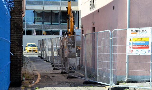
Image: © Albert Bridge Taken: 6 Jul 2013
The view along Clarke’s Lane Image towards Curtis Street. The excavator is on this site Image (51-57 York Street). The building on the right is the former Play Board building (59-65 York Street Image). It’s not clear whether Clarke’s Lane will remain as a public thoroughfare after redevelopment or whether it will suffer the same fate as the Long Lane Image
Images are licensed for reuse under creativecommons.org/licenses/by-sa/2.0
Image Location
Latitude
54.604305
Longitude
-5.928635