Oldham Road Ashton under Lyne
Introduction
The photograph on this page of Oldham Road Ashton under Lyne by Paul Anderson as part of the Geograph project.
The Geograph project started in 2005 with the aim of publishing, organising and preserving representative images for every square kilometre of Great Britain, Ireland and the Isle of Man.

There are currently over 7.5m images from over 14,400 individuals and you can help contribute to the project by visiting https://www.geograph.org.uk
Oldham Road Ashton under Lyne
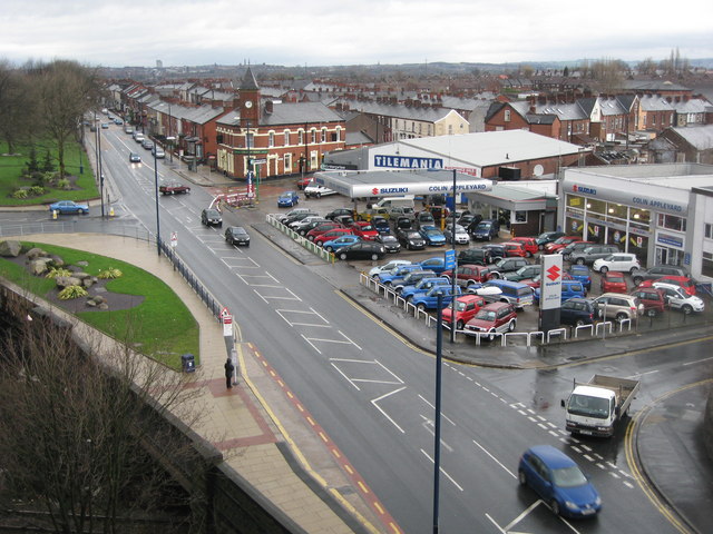
Image: © Paul Anderson Taken: 4 Mar 2007
This is the A627 out of Ashton once the main route to Oldham it used to be very busy until the final section of the M60 motorway ring road opened a few years ago. The tall building on the horizon to the left is Image This picture was taken from the roof of Image
Images are licensed for reuse under creativecommons.org/licenses/by-sa/2.0
Image Location
Latitude
53.492705
Longitude
-2.100344