Netherwood Farm
Introduction
The photograph on this page of Netherwood Farm by Bob Forrest as part of the Geograph project.
The Geograph project started in 2005 with the aim of publishing, organising and preserving representative images for every square kilometre of Great Britain, Ireland and the Isle of Man.

There are currently over 7.5m images from over 14,400 individuals and you can help contribute to the project by visiting https://www.geograph.org.uk
Netherwood Farm
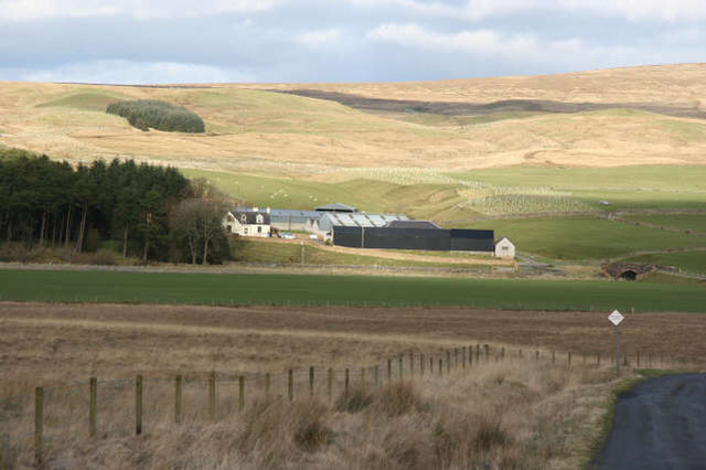
Image: © Bob Forrest Taken: 26 Feb 2007
The farm is located at a bridging point and just above the floodplain of the Greenock Water. It is a farm with an interest in both sheep and beef cattle. Located on the south facing slopes of a ridge running up to the summit of Middlefield Law (Image), there is a marked contrast between the improved grassland round the farm and the moorland vegetation of the north facing slope in the foreground. There are several areas of new plantings of trees along the small tributary valley above and to the side of the farm buildings.
Images are licensed for reuse under creativecommons.org/licenses/by-sa/2.0
Image Location
Latitude
55.530096
Longitude
-4.122943