Water Tower from Poundbury Hill Fort
Introduction
The photograph on this page of Water Tower from Poundbury Hill Fort by Ian Andrews as part of the Geograph project.
The Geograph project started in 2005 with the aim of publishing, organising and preserving representative images for every square kilometre of Great Britain, Ireland and the Isle of Man.

There are currently over 7.5m images from over 14,400 individuals and you can help contribute to the project by visiting https://www.geograph.org.uk
Water Tower from Poundbury Hill Fort
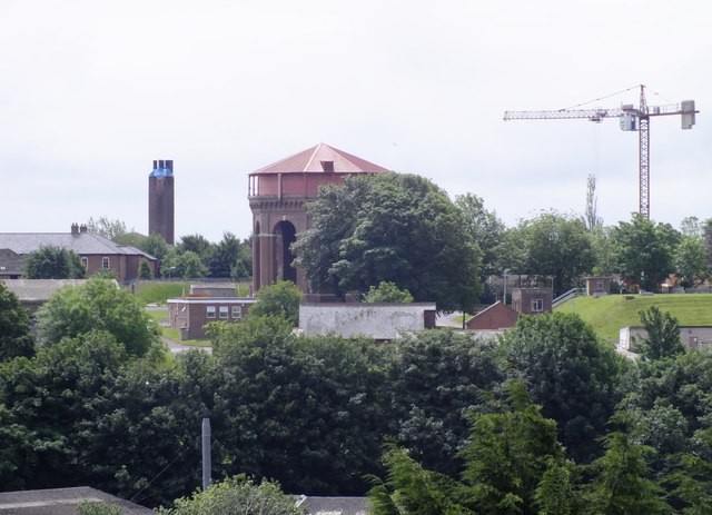
Image: © Ian Andrews Taken: 21 Jun 2013
This is the view from the ramparts of Poundbury Hill Fort looking roughly south south east. The large chimney with the blue cap to the left is the Dorset County Hospital Chimney. The crane is working on the old fire station site and in the centre is the Victorian water tower. The two field maples in front of the tower are probably the only trees in Dorset that I'd like to see removed; just so I could get a better view of the water tower. The collection of small buildings in front of the tower are those of the water works and you can just see the edge of the small covered reservoir on the right.
Images are licensed for reuse under creativecommons.org/licenses/by-sa/2.0
Image Location
Latitude
50.714074
Longitude
-2.449227