Site of former Fishponds station, 1992
Introduction
The photograph on this page of Site of former Fishponds station, 1992 by Ben Brooksbank as part of the Geograph project.
The Geograph project started in 2005 with the aim of publishing, organising and preserving representative images for every square kilometre of Great Britain, Ireland and the Isle of Man.

There are currently over 7.5m images from over 14,400 individuals and you can help contribute to the project by visiting https://www.geograph.org.uk
Site of former Fishponds station, 1992
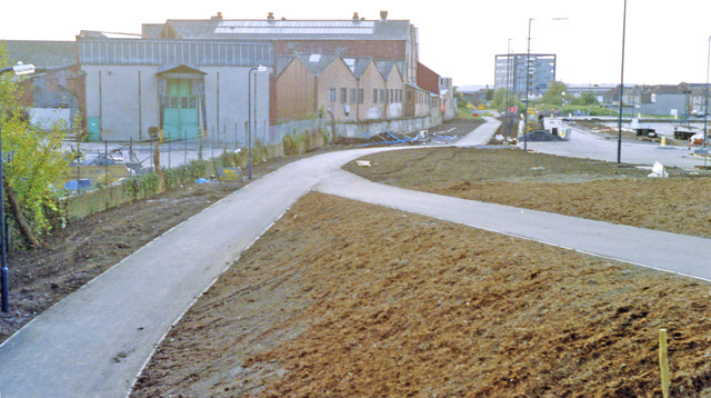
Image: © Ben Brooksbank Taken: 24 Oct 1992
View westward, towards Bristol Temple Meads: ex-Midland Bristol - Birmingham main line. The station was closed 7/3/66 along with the section of the main line from Bristol Temple Meads East through Mangotsfield to Yate South Junction; subsequently all trains to Gloucester and the North have used the ex-GWR route through Filton Junction and Bristol Parkway. (Cf. The 1972 image at Image], when some remains of the station were still left).
Images are licensed for reuse under creativecommons.org/licenses/by-sa/2.0
Image Location
Latitude
51.477618
Longitude
-2.530272