Bleak Hills Lane, Mansfield, Notts.
Introduction
The photograph on this page of Bleak Hills Lane, Mansfield, Notts. by David Hallam-Jones as part of the Geograph project.
The Geograph project started in 2005 with the aim of publishing, organising and preserving representative images for every square kilometre of Great Britain, Ireland and the Isle of Man.

There are currently over 7.5m images from over 14,400 individuals and you can help contribute to the project by visiting https://www.geograph.org.uk
Bleak Hills Lane, Mansfield, Notts.
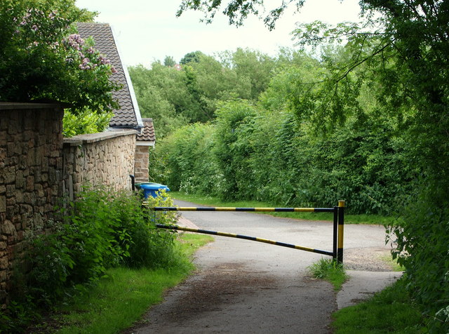
Image: © David Hallam-Jones Taken: 16 Jun 2013
Observers standing here are facing the start of (or the conclusion of) the asphalted end of Bleak Hills Lane, a road that runs from Sheepbridge Road and High Oakham Hill to this point. Current maps still identify this property as "Beeton's Cottage", although it looks as though this has been replaced by this large replacement called Bleak Hills House. On the right, behind the 'turning place', are a set of locked 7ft high mesh/grid gates and on the other side of which is a grassed track that has the potential to link up with Cauldwell Road via Lower Oakham, although who has rights of access is not clear. Behind the photographer is a footpath that connects with Hamilton Way in the vicinity of a 'light industrial' zone in the Bleak Hills area.
Images are licensed for reuse under creativecommons.org/licenses/by-sa/2.0
Image Location
Latitude
53.129766
Longitude
-1.2092