Cauldwell Road Cul-de-Sac, Mansfield.
Introduction
The photograph on this page of Cauldwell Road Cul-de-Sac, Mansfield. by David Hallam-Jones as part of the Geograph project.
The Geograph project started in 2005 with the aim of publishing, organising and preserving representative images for every square kilometre of Great Britain, Ireland and the Isle of Man.

There are currently over 7.5m images from over 14,400 individuals and you can help contribute to the project by visiting https://www.geograph.org.uk
Cauldwell Road Cul-de-Sac, Mansfield.
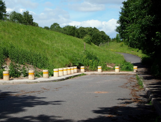
Image: © David Hallam-Jones Taken: 16 Jun 2013
The construction of the A611 in 2005 bisected Cauldwell Road near Rushey Cottage. This is termination of the now-isolated western section of Cauldwell Road with a footpath that allows walkers and cyclists to access another section of Cauldwell Road on the other side of the A611, that is just about visible ahead.
Images are licensed for reuse under creativecommons.org/licenses/by-sa/2.0
Image Location
Latitude
53.119836
Longitude
-1.202957