Royal Geographical Society
Introduction
The photograph on this page of Royal Geographical Society by David Hawgood as part of the Geograph project.
The Geograph project started in 2005 with the aim of publishing, organising and preserving representative images for every square kilometre of Great Britain, Ireland and the Isle of Man.

There are currently over 7.5m images from over 14,400 individuals and you can help contribute to the project by visiting https://www.geograph.org.uk
Royal Geographical Society
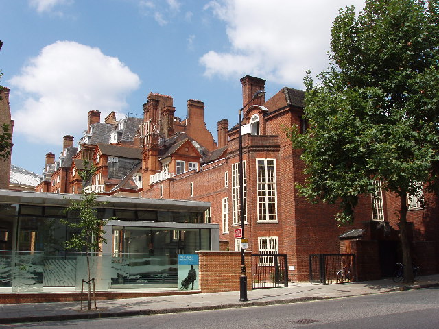
Image: © David Hawgood Taken: 8 Aug 2005
Taken looking across the top of Exhibition Road. The low building on the left is The Pavilion, an exhibition space and the entry to the library and archives, which are under the garden. Behind The Pavilion is the old part of Lowther Lodge, on the right is the lecture theatre. The RGS has an outstanding library of maps and travel books.
Images are licensed for reuse under creativecommons.org/licenses/by-sa/2.0
Image Location


Leaflet Map data © OpenStreetMap
Latitude
51.501122
Longitude
-0.174578